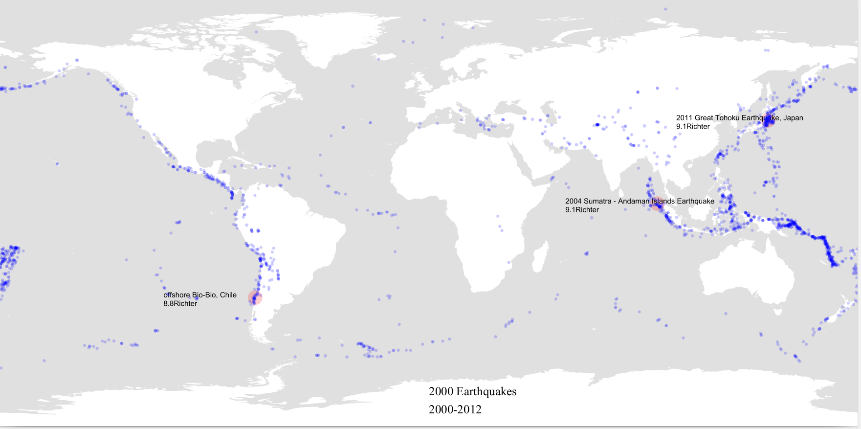
Mapping Earthquakes Locations on a Map
Introduction This is a data visualization program made using processing.py, I made it a few years ago, however, I think it’s a great program that deserves recognition.
You can find the code and the data used here.
Data The program uses a csv file containing 2000 locations of earthquakes (longitude and latitude), the magnitude of the earthquakes, and the name of the place where they occurred (a string). Here is the source of the data